
Walk a Will County Street
Begin with the exact number and street name, but keep the city and postal label separate. Will County spans 31 municipalities and 24 townships, and a postal name may not match the incorporated place. The Supervisor of Assessments address search accepts a number, a street name, or both. City/Town is optional. Its match is a parcel lead, not proof that every person named there occupies the site.
The strongest street directory trail joins records through the PIN, the parcel identification number. That key connects the assessor, GIS map, Recorder index, and tax context even when spelling or street labels vary. Work in a fixed order and write down the source date for each result.
- Normalize the house number, street name, municipality, and ZIP. If county data disagrees, use Will County 9-1-1 address verification.
- Search the assessor by address and copy the PIN. Try the street alone when the full address returns no match.
- Open the GIS viewer, turn on parcels and address points, and click each parcel along the road.
- Use the PIN, address, and owner name as separate searches in Recorder Direct Search.
- For a permitted individual check, use the county voter form. For older occupants, ask a library for a street or criss-cross directory.
Search Will County by Address
The Supervisor of Assessments compiles current data from local township assessors. Its address form is unusually flexible, so a broad street-directory search can begin without a PIN. Use fewer fields first, then add the city only to narrow a long result set.
| Search field | How it works |
|---|---|
| Street Address Number | Optional; a number alone returns parcels containing that number. |
| Street Name | Optional; a partial street string such as Oak can return name matches. |
| City/Town | Optional narrowing field; it does not prove municipal jurisdiction. |
| Search | Submits any useful combination of number, street, and city. |
The official form is visible in the assessor source shown below.
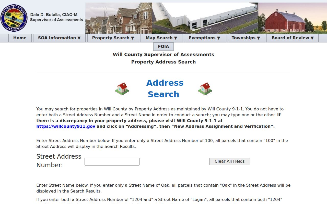
The screenshot confirms the limited set of fields. It also explains why a street-only search is a sound fallback when an exact address is indexed differently.
Map Will County Street Parcels
The Will County GIS Data Viewer carries more than 70 layers. Useful street layers include parcels, address points, roadways, municipalities, townships, ZIP codes, tax-map labels, zoning, historic sites, districts, flood data, and aerial images from 1939 through 2026. A map click can show a PIN, situs fields, tax class, values, dates, and geometry.
For a whole road, click parcels one at a time. A narrow official REST query is safer than a broad download because a street-name result can exceed the service transfer limit. The sample county parcel query illustrates that field-based method.
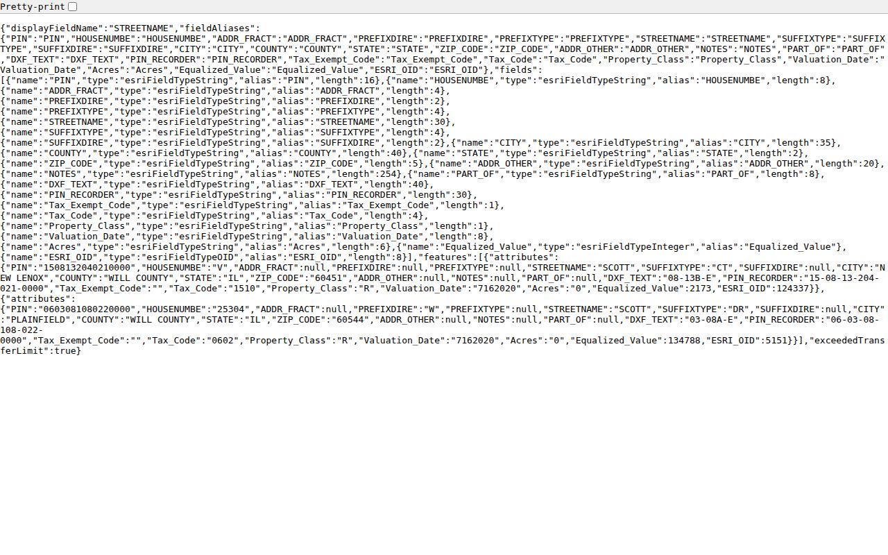
The result is map and assessment evidence. It must still be checked against an assessor record and deed before an ownership claim is made.
Link Will County Streets to Deeds
The Will County Recorder Direct Search can search Party, Date Range, Document Type, Book/Page, Address/Legals, Subdivision/Lot-Block, and Parcel criteria. The public index is free and generally covers online documents from 1965 forward. Plats reach back to 1836, while older deeds and images may require the main office, archives, fax, or email.
Address searches work better when street suffixes such as St, Dr, and Ave are omitted. Add a percent sign for a partial street match. PINs also vary: the Recorder may omit four trailing zeros, and county systems may show 14- or 16-digit forms. Search the address, PIN, and owner name separately rather than placing every field in one query.
The source-linked Recorder index screen is captured here.
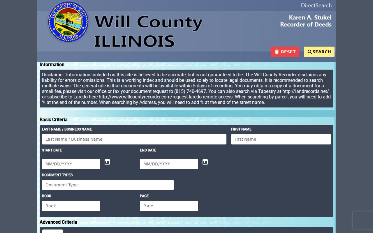
Results can expose document number, type, recorded date, parties, book and page, legal summary, address, parcel, and subdivision. The free configuration does not promise document images.
Will County Street Search Quirks
A small spelling choice can hide an otherwise valid record. Direct Search favors the base street name without a suffix, supports a percent wildcard, and may store the PIN without its trailing zeros. This Profile 4 interest point is more useful than repeatedly submitting the same exact address.
- Parcel
- A mapped unit of land identified by a PIN.
- Situs address
- The physical location assigned to the parcel, distinct from an owner's mailing address.
- Plat
- A recorded map that defines lots, blocks, streets, or subdivisions.
- Criss-cross directory
- A printed directory arranged by street or address instead of only by surname.
Municipal and postal names also diverge. Official ZIP data pairs Joliet and Rockdale in 60436, and Homer Glen and Lockport in 60491. Keep both labels until the GIS municipality layer identifies the jurisdiction.
Note: A street label, ZIP polygon, or GIS parcel can narrow a search, but none alone identifies every resident at that address.
Will County Records by Street
Each address-keyed source answers a different question. A good Will County street directory keeps ownership, occupancy clues, mapped geography, and government activity in separate columns until the evidence agrees.
| Record Set | Keeper | What It Shows | Access |
|---|---|---|---|
| Assessment roll | Supervisor of Assessments | Parcel, assessed owner, sale and class leads | Free courtesy portal |
| GIS parcel map | Will County GIS | Situs, PIN, geometry, ZIP and districts | Free viewer and REST layer |
| Deeds and plats | Recorder of Deeds | Recorded parties, legal description and deed chain | Free index; paid or office copy routes |
| Voter match | Will County Clerk | One permitted name, birth date and address match | Restricted individual lookup |
| Permits and code files | Land Use or municipality | Dated work, applicant and parcel references | Counter or FOIA when portal data is absent |
| Historical directory | JPL, PAPL, museum | Dated occupant, phone or address clues | Print, microfilm, scan, or staff help |
The PIN is the safest bridge among modern systems. Street and city labels then connect the parcel to permits and historical publications. The voter form is not a block browser, and its limited public data may not be used to build a street roster.
Verify a Will County Address
Will County 9-1-1 maintains the address data used by the assessor. New addresses and discrepancies should go through its assignment and verification route. The Will County 9-1-1 source provides that official starting point.
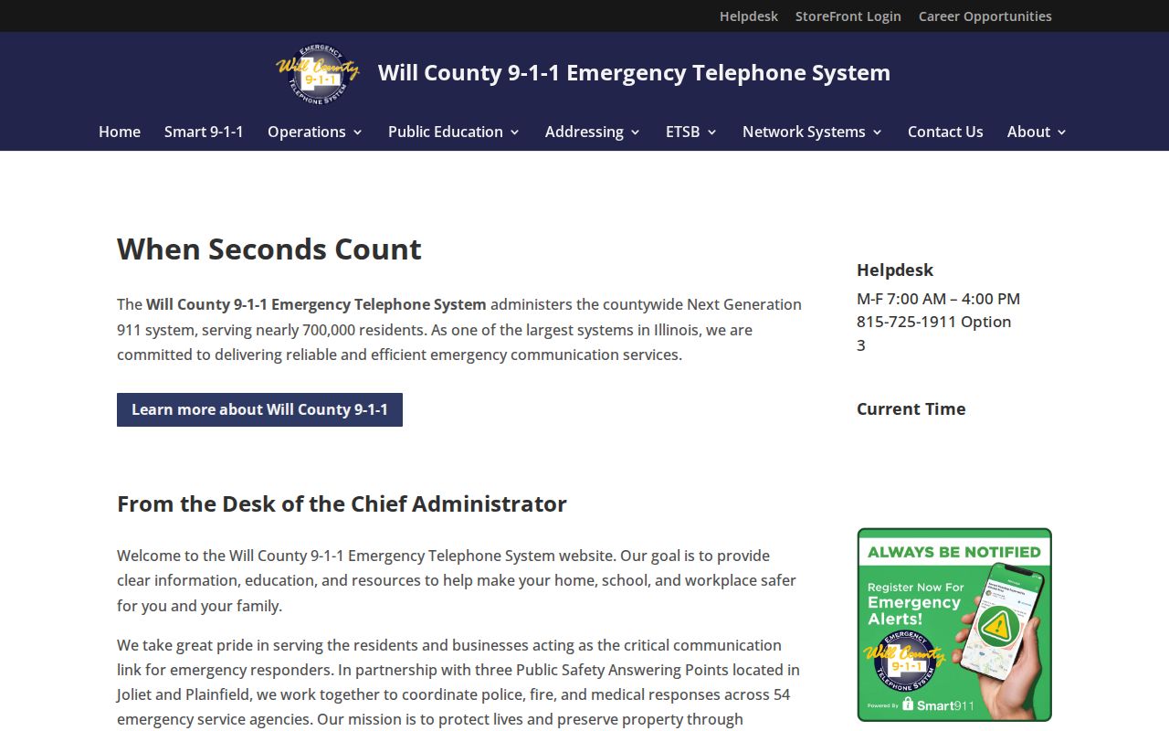
This check matters in new subdivisions, unincorporated areas, and places where a postal label differs from the municipality. A verified address can then be carried into the assessor and GIS searches.
Follow Will County Street Permits
Permits add a dated layer to the parcel trail. County Land Use handles records in its jurisdiction, while incorporated cities and villages keep their own files. When a public portal does not expose a useful address search, ask the correct office for the address, PIN, permit type, and date range.
The Development Services Division is the county route shown below.
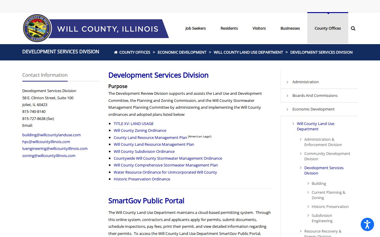
A permit can name an applicant or contractor and date physical work. It does not establish who occupied the building. Municipal FOIA is the fallback for a defined address and period.
Older Will County Street Residents
Historical address work belongs on a dated track. Joliet Public Library holds city directories from 1875 forward, telephone books from 1908, newspapers on microfilm from 1846, and county directories for 1859–60 and 1872–73. Plainfield Area Public Library adds Plainfield–Joliet runs, Lockport directories, phonebooks, and a house-history route. Ask staff for an address section, reverse volume, or criss-cross book by year because no complete local reverse-series list was found.
Use a printed occupant as a clue, then confirm it with a deed, obituary, census page, or newspaper. The collections themselves are described on the Will County city directory page. Street-level work should cite the title, year, and page used.
Will County Street Record Fallbacks
Online tools are only one access channel. The Recorder's main office at 158 N Scott Street in Joliet has public workstations, microfilm viewers, historical indexes, deed books, plat books, and maps. Staff can start a search, but the public performs detailed research. Earlier images can be requested by fax or email when a document number is known.
For a county permit or record series not posted online, a focused Illinois FOIA request should state the address, PIN, date range, desired format, and whether inspection or copies are wanted. Library staff and historical societies cover the print and microfilm gap. These routes make the street directory usable even when a portal has no image or a spelling mismatch blocks a result.
Compare Will County Street Dates
Every address record has its own clock. Assessment data reflects a tax cycle, while a deed's recording date marks when the Recorder accepted an instrument. A permit date marks an application, inspection, or approval. Voter information reflects registration, and a printed directory represents one publication year. Put the source and date beside each name before comparing results.
The assessor's sale search accepts dates, sale amount, match type, municipality, township, and subdivision. A sale can identify a transfer worth checking in Direct Search, but it does not establish the day a household arrived or left. Use the parcel PIN and recorded document number to keep similarly named properties apart.
Address-point and parcel datasets may change on different schedules. If a new subdivision appears on the map but not under the expected street form, search its subdivision name and PIN, then ask which office dataset is current.
Read Will County Legal Descriptions
A street address is convenient, but the legal description is the stable land reference in a deed. It may name a lot, block, subdivision, section, township, and range. A plat is the recorded drawing that lays out lots, roads, and easements. When a road was renamed, renumbered, extended, or annexed, the legal description and PIN can bridge the old label to the current parcel.
Will County's Recorder system includes plat material back to 1836, even though ordinary online documents are generally available from 1965 forward. Earlier deed books and unavailable images require archive workstations, microfilm, staff help, email, fax, or a copy request. Keep volume and page references because those citations tell staff where to look.
Do not use a tax map as a substitute for a survey or recorded title. It locates the parcel, while the deed and plat preserve the formal description. That distinction matters on rural roads, corner lots, combined parcels, and streets crossing municipal lines.
Limits of Will County Street Records
An assessed owner may live elsewhere. A mailing address may differ from the situs, and a deed identifies recorded parties rather than every occupant. Household members, guests, utility customers, delivery recipients, and visitors are not established by parcel data. Illinois driver-address information is restricted, voter data is limited, and protected Address Confidentiality Program records must not be reverse engineered.
Commercial neighbor tools may merge stale and unrelated data. Official records are narrower, but each has a named custodian and a clear date. Use a street directory for family research, property history, civic questions, or scam verification, and confirm any important claim with the office that holds the record.
Lawful use. Will County address records are for lawful personal research. Never use them to stalk, harass, threaten, or intimidate another person.